
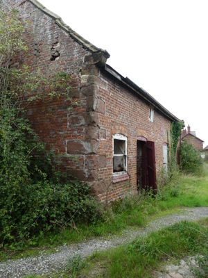
Granary 30 metres east of Shotwicklodge Farmhouse
Granary 30 metres east of Shotwicklodge Farmhouse, Grade II listed granary near Shotwick, Cheshire West and Chester, Cheshire, UK
Ubicación: Saughall and Shotwick Park
Fundación: 1653
Coordenadas GPS: 53.23544,-2.97292
Última actualización: 13 de marzo de 2025 a las 19:09

Shotwick Castle
941 m
Shotwick House
1.3 km
St Michael's Church, Shotwick
1.5 km
Shotwick Hall
1.6 km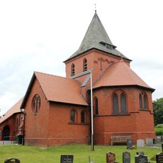
All Saints Church, Great Saughall
1.5 km
The Old Swinging Gate Inn
1.7 km
Bridge Farmhouse
1.7 km
Gates, gatepiers and churchyard wall along north side of Shotwick Lane
1.5 km
Front garden walls and gatepiers at Shotwick Hall
1.6 km
Tombchest of Robert and Martha Ellison, 10 metres southwest of south corner of tower of Church of St Michael
1.5 km
Manor Farmhouse
1.5 km
L-shaped ranges of farm buildings 60 metres north of Shotwick Hall
1.6 km
Tombchest of James Phillips, 2 metres south of the sundial in the Churchyard of St Michael
1.5 km
Sundial in the churchyard of St Michael
1.5 km
Greyhound Farmhouse
1.5 km
Former kitchen or bakehouse attached to north east corner of Shotwick Hall
1.6 km
Tombchest of John Nevett Bennett, 5 metres west of south porch of St Michael's Church
1.5 km
Tombchest of Rev M Reay and 4 children, 8 metres south of south porch of Church of St Michael
1.5 km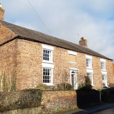
Aldersey House
1.6 km
Tombchest of William Briscoe (died 1723) and others, 4 metres west of priest's door to St Michael's Church
1.5 km
Tombchest of William Briscoe (died 1704) and others, 5 metres southwest of priest's door to St Michael's Church
1.5 km
Footpath guidepost 25 metres south west of Bridge Farmhouse
1.7 km
Vicarage Farmhouse
1.5 km
Barn 70 metres north east of Shotwicklodge Farmhouse
43 m
North Pair of Aircraft Hangars
2.1 km
South Pair of Aircraft Hangars
2.2 km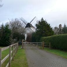
Gibbet Windmill
1.4 km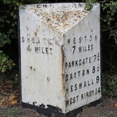
Milepost, Saughall Nurseries
1.8 km¿Has visitado este lugar? Toca las estrellas para valorarlo y compartir tu experiencia o fotos con la comunidad. ¡Pruébalo ahora! Puedes cancelarlo en cualquier momento.
¡Encuentra tesoros escondidos en cada aventura!
Desde cafeterías con encanto hasta miradores secretos, escapa de las multitudes y encuentra lugares que van contigo de verdad. Nuestra app te lo pone fácil: búsqueda por voz, filtros inteligentes, rutas optimizadas y consejos auténticos de viajeros de todo el mundo. ¡Descárgala ya y vive la aventura en tu móvil!

Un enfoque novedoso para descubrir el turismo❞
— Le Figaro
Todos los lugares que merecen ser explorados❞
— France Info
Una excursión a medida en solo unos clics❞
— 20 Minutes