Activar ubicación

Necesitamos tu ubicación para mostrarte lugares interesantes cerca de ti

Descubre lugares cercanos

Encuentra lugares interesantes y joyas ocultas a tu alrededor

Direcciones precisas

Obtén direcciones precisas y distancias a los lugares

Tu ubicación nunca se comparte con otros usuarios. Solo se usa cuando tocas el botón de ubicación.

Garsdale

Inicia sesión en tu cuenta

Empieza a explorar — es gratis

Elegido por 61.456 viajeros en todo el mundo

Continuar con Google
Continuar con Apple
o

Te enviaremos un código para conectarte

Al continuar, aceptas nuestros Términos y Condiciones y nuestra Política de Privacidad

Revisa tu bandeja de entrada

Hemos enviado un código PIN a su bandeja de entrada. Por favor ingrese el código a continuación.

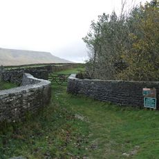
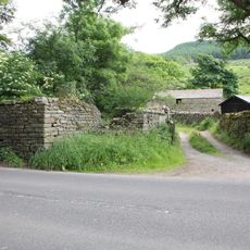
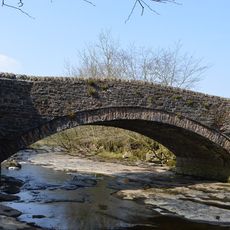
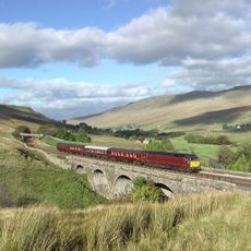
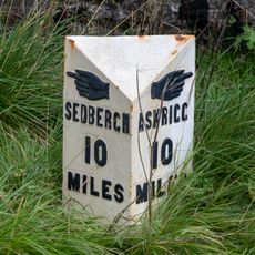
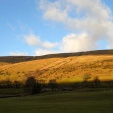
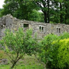
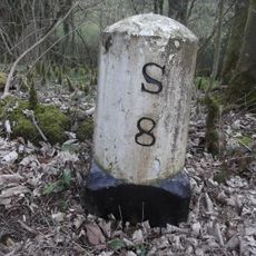
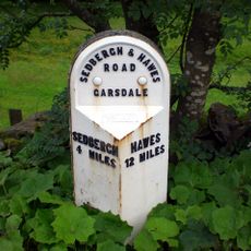
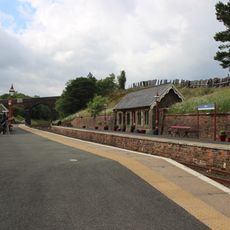
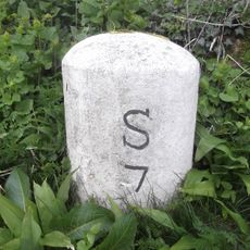
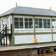
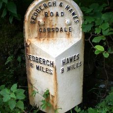
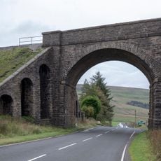
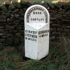
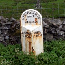
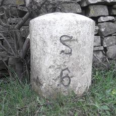
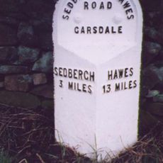
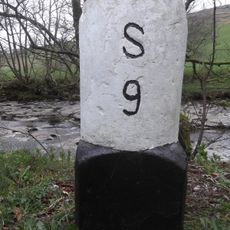
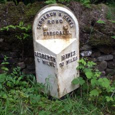
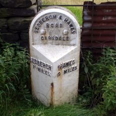
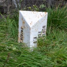
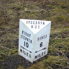
Garsdale, village in Cumbria, England, UK

Ubicación
Westmorland and Furness
Coordenadas GPS
54.30120,-2.39251
Última actualización
12 de marzo de 2025 a las 06:06

AroundUs reúne miles de lugares seleccionados, consejos locales y joyas escondidas, enriquecidos cada día por más de 60,000 colaboradores en todo el mundo. Descubrir todos los lugares cercanos (Westmorland and Furness).

Alrededor de este lugar
Dandrymire Viaduct
Reino Unido

Dandrymire Viaduct

5.5 km
Baugh Fell
Reino Unido

Baugh Fell

2.1 km
St John the Evangelist's Church, Cowgill
Reino Unido

St John the Evangelist's Church, Cowgill

2.8 km
Uldale Force
Reino Unido

Uldale Force

6.2 km
Church of St John the Baptist
Reino Unido

Church of St John the Baptist

80 m
Hell Gill Bridge
Reino Unido

Hell Gill Bridge

8.4 km
Dandra Garth
Reino Unido

Dandra Garth

784 m
Ewegales Bridge
Reino Unido

Ewegales Bridge

2.9 km
Ais Gill Viaduct
Reino Unido

Ais Gill Viaduct

8.4 km
Garsdale Milestone Immediately East Of Boundary Marker
Reino Unido

Garsdale Milestone Immediately East Of Boundary Marker

5.7 km
East Rackenthwaite And Adjoining Barn
Reino Unido

East Rackenthwaite And Adjoining Barn

1.5 km
Gibbs Hall
Reino Unido

Gibbs Hall

3.4 km
Milestone (Sedbergh 8) Approximately 200 Metres East Of Broadfield Lane On South Side Of Road
Reino Unido

Milestone (Sedbergh 8) Approximately 200 Metres East Of Broadfield Lane On South Side Of Road

3.2 km
Milestone (Sedbergh 4) Approximately 20 Metres West Of Bellow Hill Turn
Reino Unido

Milestone (Sedbergh 4) Approximately 20 Metres West Of Bellow Hill Turn

3 km
Passenger Waiting Room On East Side Of Railway Track At Dent Station
Reino Unido

Passenger Waiting Room On East Side Of Railway Track At Dent Station

2.8 km
Milestone (Sedbergh 7) Approximately 170 Metres West Of Sundial Cottage
Reino Unido

Milestone (Sedbergh 7) Approximately 170 Metres West Of Sundial Cottage

3.6 km
Garsdale Signal Box
Reino Unido

Garsdale Signal Box

4.9 km
Milestone (Sedbergh 8) Approximately 5 Metres East Of Scar Foot Bridge
Reino Unido

Milestone (Sedbergh 8) Approximately 5 Metres East Of Scar Foot Bridge

2.8 km
Moorcock Road railway bridge
Reino Unido

Moorcock Road railway bridge

5.7 km
Milestone (Sedbergh 4) By High Wardses
Reino Unido

Milestone (Sedbergh 4) By High Wardses

8.1 km
Milestone (Sedbergh 9) Approximately 250 Metres East Of Harding Bridge (Not Included)
Reino Unido

Milestone (Sedbergh 9) Approximately 250 Metres East Of Harding Bridge (Not Included)

4.3 km
Milestone (Sedbergh 6) Approximately 5 Metres West Of Hallbank Lane
Reino Unido

Milestone (Sedbergh 6) Approximately 5 Metres West Of Hallbank Lane

4.1 km
Milestone (Sedbergh 3) Approximately 10 Metres East Of Nether House (Not Included)
Reino Unido

Milestone (Sedbergh 3) Approximately 10 Metres East Of Nether House (Not Included)

4.5 km
Milestone (Sedbergh 9) On South Side Of Road Approximately 50 Metres South West Of Cowgill Bridge
Reino Unido

Milestone (Sedbergh 9) On South Side Of Road Approximately 50 Metres South West Of Cowgill Bridge

2.9 km
Milestone (Sedbergh 6) Approximately 75 Metres West Of Kirk Bridge
Reino Unido

Milestone (Sedbergh 6) Approximately 75 Metres West Of Kirk Bridge

120 m
Milestone (Sedbergh 7) Approximately 10 Metres West Of East Little Town
Reino Unido

Milestone (Sedbergh 7) Approximately 10 Metres West Of East Little Town

1.3 km
Garsdale Boundary Marker At Country Boundary Of North Yorkshire And Cumbria
Reino Unido

Garsdale Boundary Marker At Country Boundary Of North Yorkshire And Cumbria

5.7 km
Milestone, ½ mile N of Moorcock Inn
Reino Unido

Milestone, ½ mile N of Moorcock Inn

6.1 km
Mostrar el mapa completo
Garsdale - village in Cumbria, England, UK es proporcionado por Around Us (es.aroundus.com). Las imágenes y los textos provienen del proyecto Wikimedia bajo una licencia Creative Commons. Se permite copiar, distribuir y modificar copias de esta página, bajo las condiciones establecidas por la licencia, siempre y cuando este aviso aparezca claramente.

¡Encuentra tesoros escondidos en cada aventura!

Desde cafeterías con encanto hasta miradores secretos, escapa de las multitudes y encuentra lugares que van contigo de verdad. Nuestra app te lo pone fácil: búsqueda por voz, filtros inteligentes, rutas optimizadas y consejos auténticos de viajeros de todo el mundo. ¡Descárgala ya y vive la aventura en tu móvil!

Around Us App Screenshot

Un enfoque novedoso para descubrir el turismo

Le Figaro

Todos los lugares que merecen ser explorados

France Info

Una excursión a medida en solo unos clics

20 Minutes

Around Us
Guía de viaje y mapas
Descargar

Enviar a tu teléfono

QR Code
1

Abre la cámara en tu móvil.

2

Apunta al código QR con tu cámara. Aparecerá una notificación.

3

Toca la notificación para abrir el enlace.